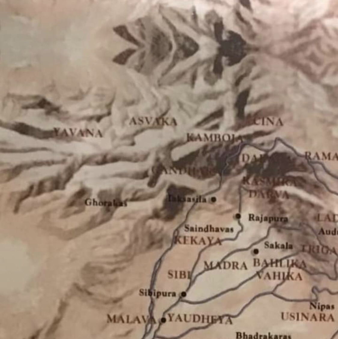
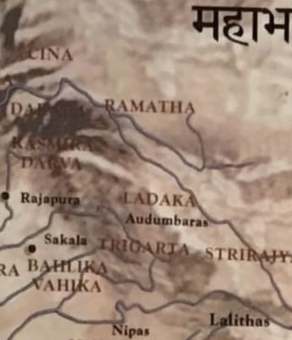
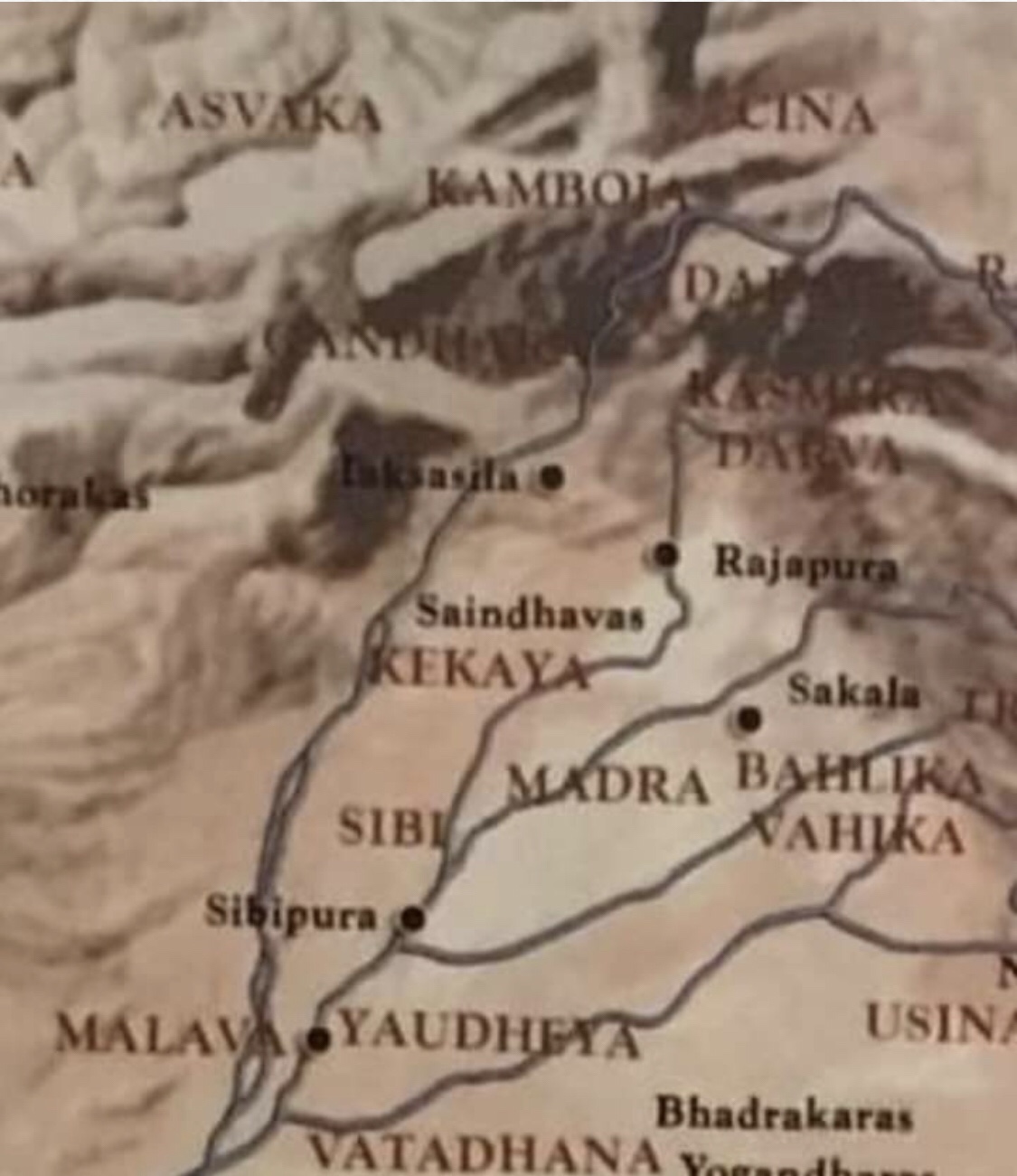
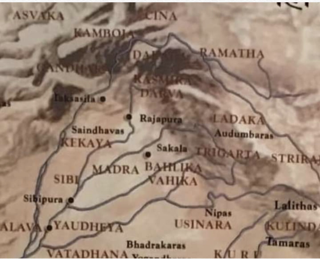
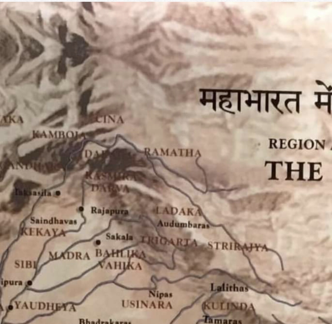
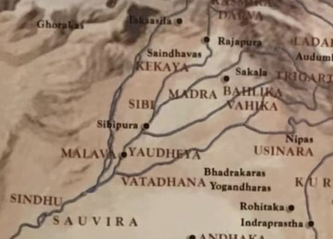
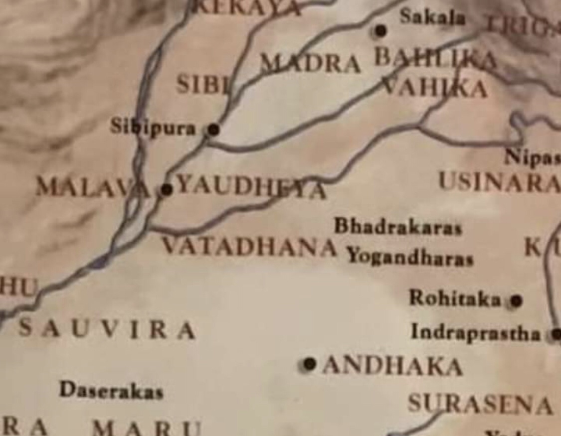
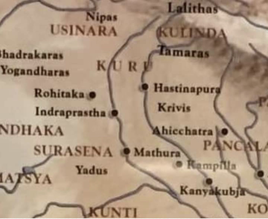
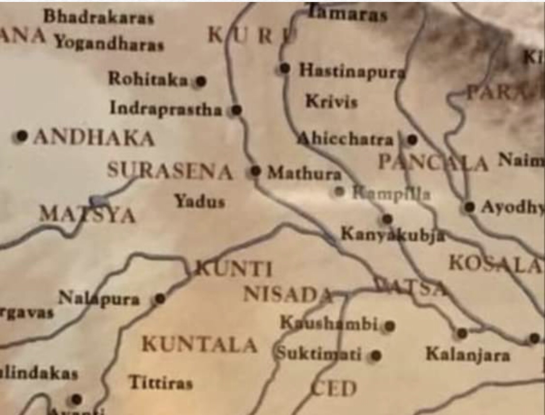
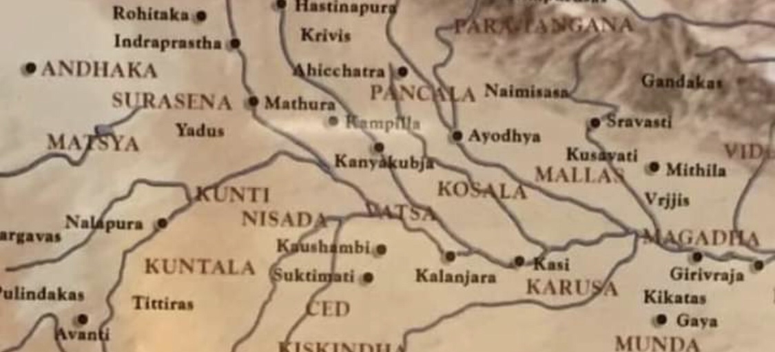
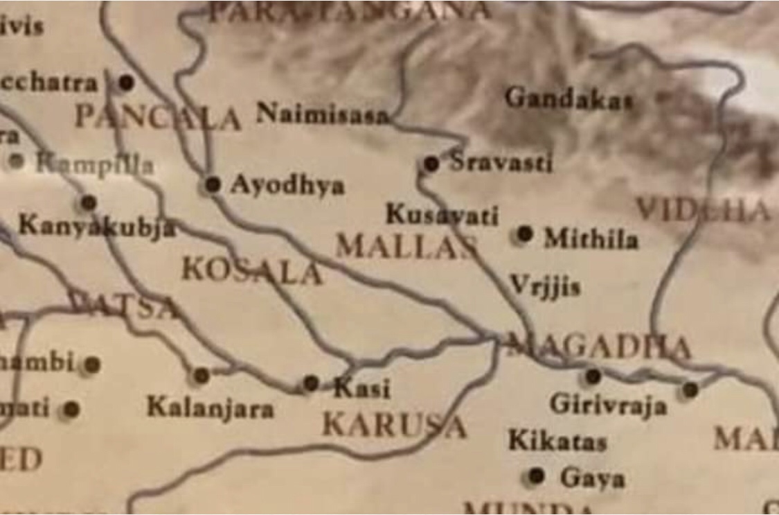
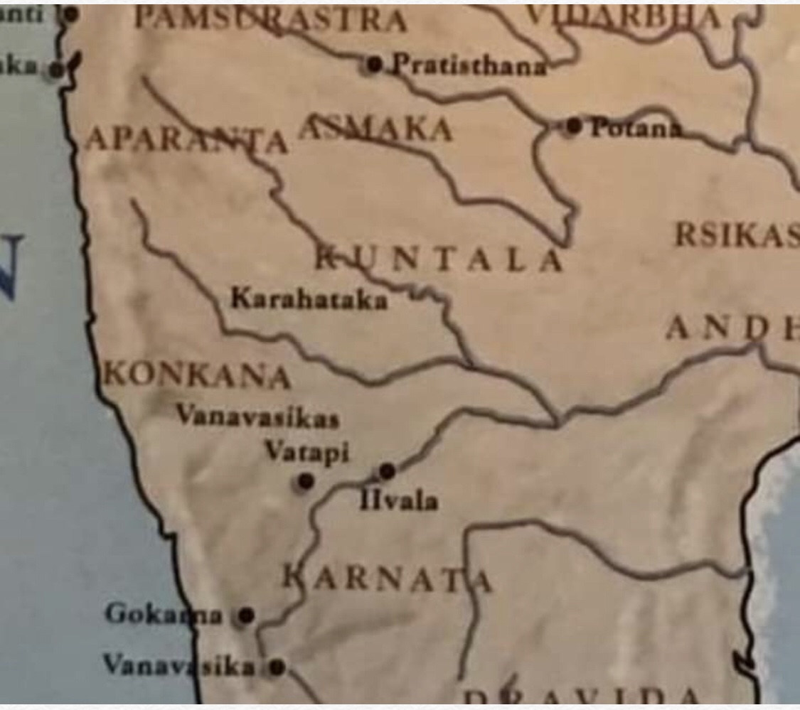
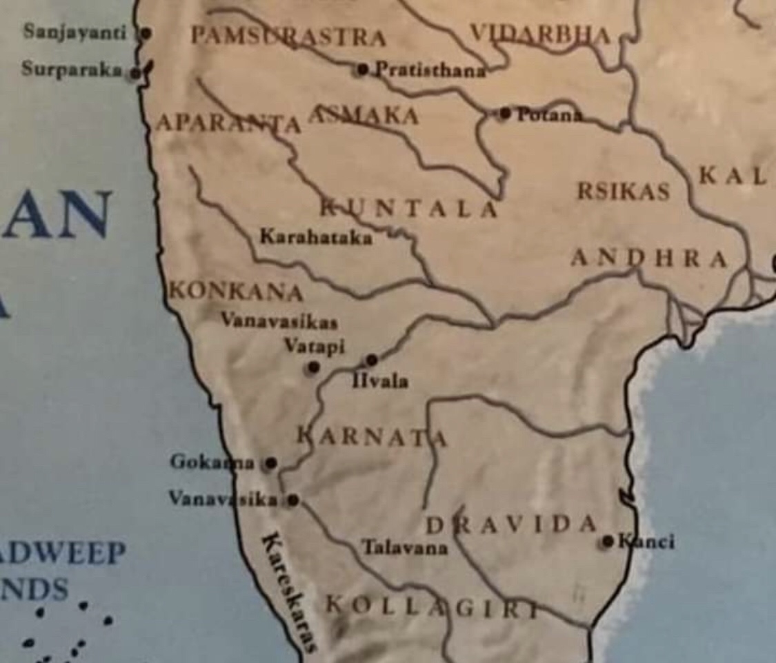
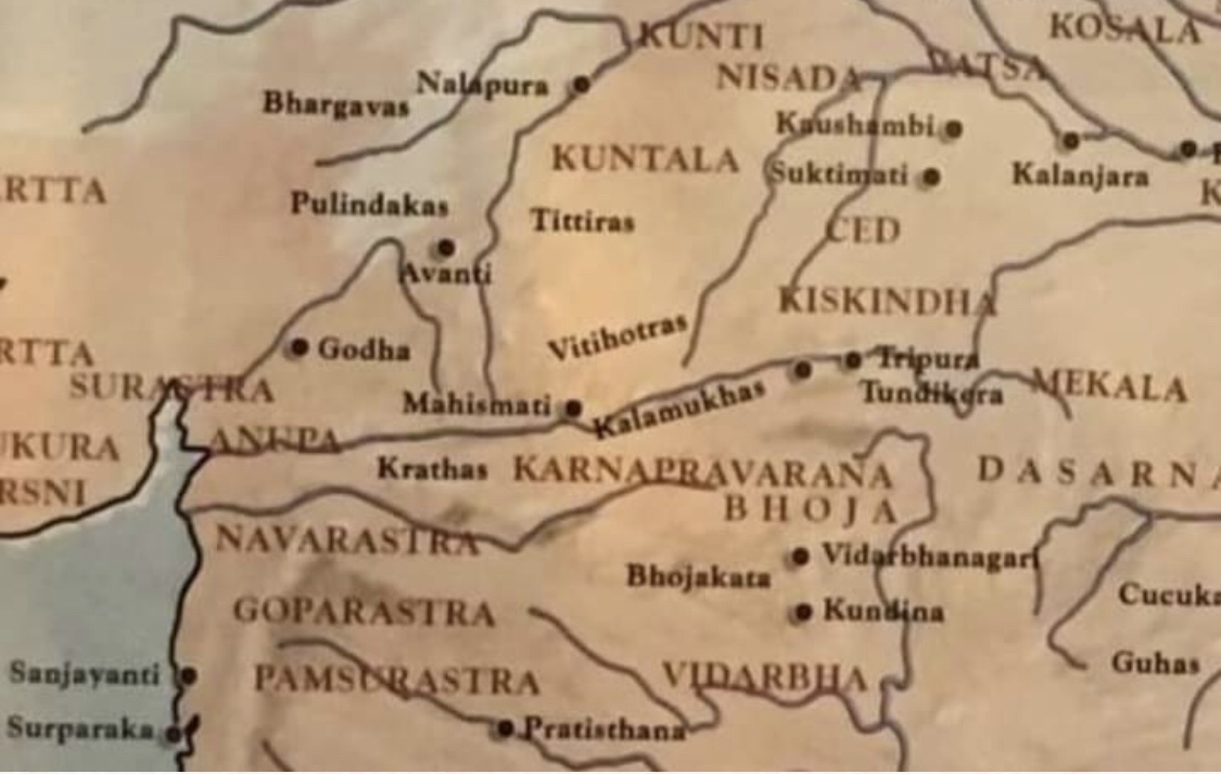
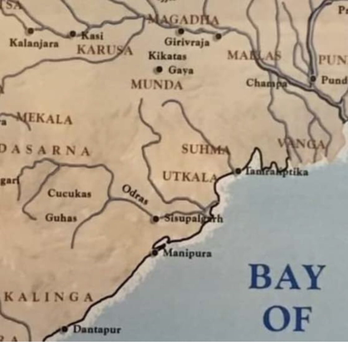
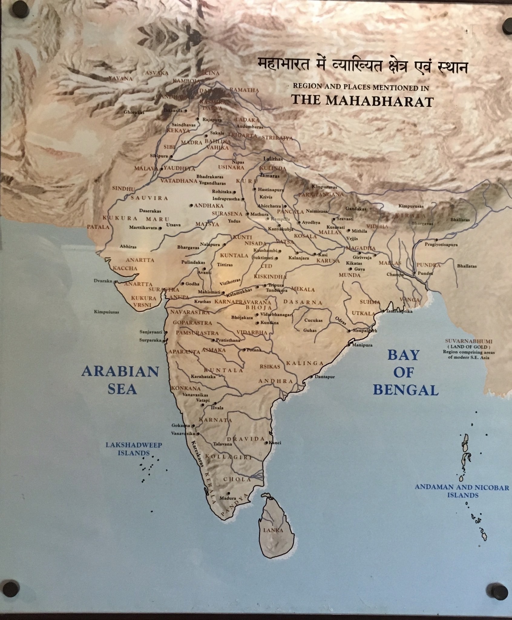
Here is a fascinating map of all the places of ancient India as mentioned in Mahābhārata.
This map is put on display in Purana Qila, which is the ancient Indraprastha of Mahābhārata.
Take a look at the map and see the name of your region during those days.
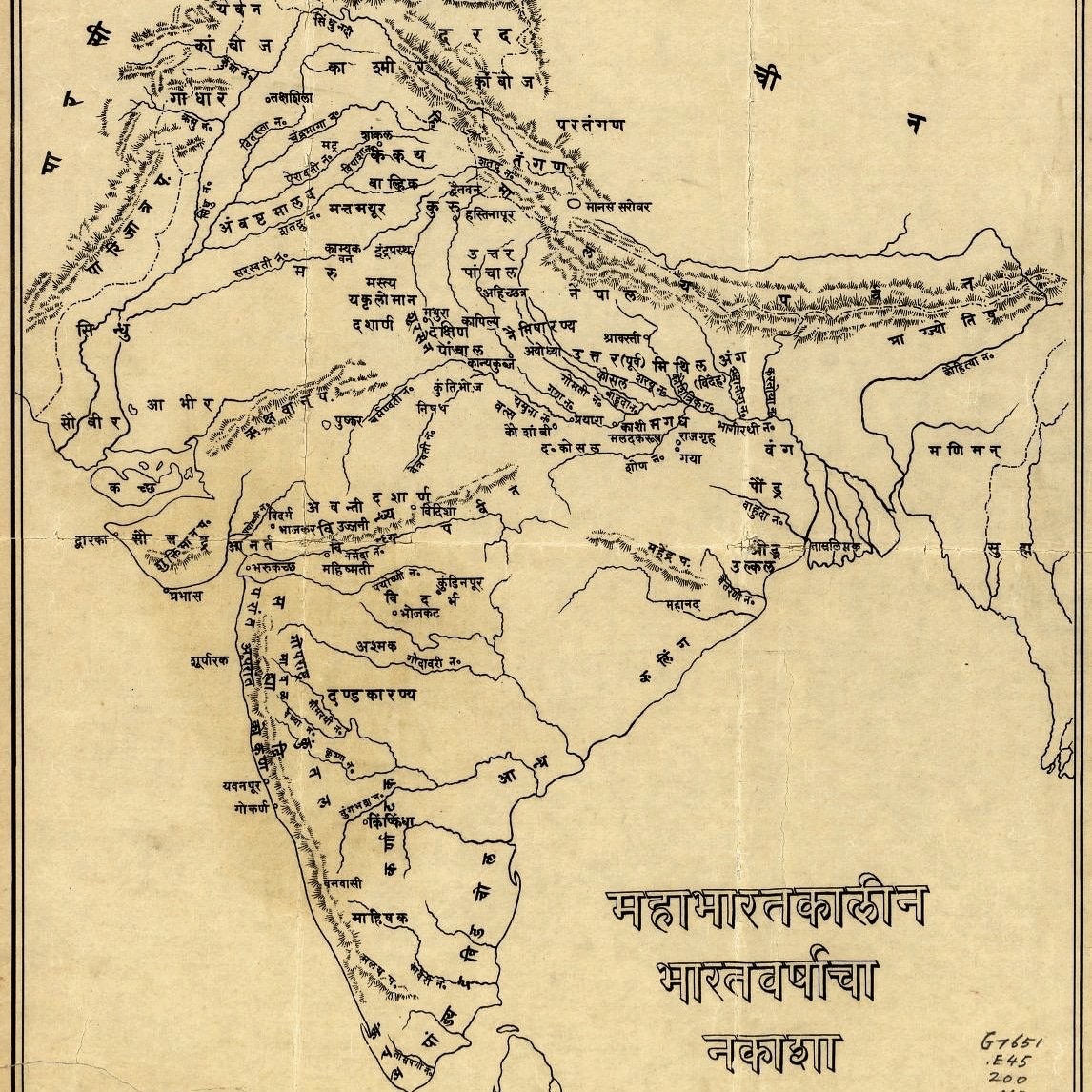
Mahābhārata is simply the encyclopedia of ancient India. The geographical details are very comprehensive. Below in this compilation, I shall elaborate upon every region
To the NW in Afghanistan is country of Yavanas, the Bactrian Indo-Greeks (Modern Begram). To their East in Hindukush is the country of Aśvakas and Kāmbojas. The Kamviri Nuristanis of Afghanistan, Kamboj of Punjab and Kammas of Andhra Pradesh could be their partial descendants.

To their immediate east are the Cīnās, Lāḍakas (Ladakh) and Rāmaṭhas(Bhotas). These were Tibetan people . Chinese were known as Mahācīnās.

To the south of Kāmbojas is the country of Gāndhāra with its capital at Takshashila (Taxila). This is the Attock-Swat-Charsadda-Peshawar-Islamabad region. To the south of Gāndhāra is the kingdom of Kekaya, which is the modern Dera Ismail Khan region between Jhelum and Indus.

To their south is the kingdom of Sibi and its capital Sibipura(which is the modern Sehwan).
To their east in the modern Majha region of Punjab is the ancient kingdom of Madrā. To their east is Vāhikas on the other side of the river Iravati(Ravi).

Bahlikas is misplaced in this map and they should really belong to Balkh, Afghanistan.
To the North of Vāhikas is the kingdom of Trigarta with its capital at Sakala(Sialkot). This is the Jammu-Sialkot region.

To their north is the kingdom of Kashmir (Kaśmīra) with its capital at Rājapura (Rajouri). Remember that Shrinagara (Srinagar) was established by Ashoka who post dates Mahābhārata. As such, it does not appear in this map

To the North of Kashmir is the kingdom of Daradas (dards of Gilgit-Chitral-Yasin).
To the east of Trigarta is the kingdom of “Audumbaras” which is the ancient kingdom of Himachal. To their east is the kingdom of “Khasas” who are the Nepali people speaking “Khas kura”.

Interestingly, Malavas and Yaudheyas still inherit the Indus-Satluj region in the Mahābhārata. In the post Mahābhārata age, Malavas win over lands from east Punjab to Madhya Pradesh.
Malwa of East Punjab (Ludhiana) and Malwa of Madhya Pradesh is still named after this tribe.

Yaudheyas also moved east and conquered Haryana region. They established their capital at Rohitaka (Rohtak). To the south of Punjab are ‘Sauviras’, who are the modern ‘Saraiki’ speakers of Sindh-Multan.

To their east is the kingdom of Kuru, the modern Haryana region around Delhi. It had two capitals- Indraprastha (Delhi) and Hastinapura (Meerut). To their South-East is the kingdom of Panchalas. It also had two capitals. “Ahicchatra” in the north and “Kampilya” in the south.

According to Mahābhārata, Ahicchatra was ruled by Drona’s son Ashvatthama.
As Guru Dakshina, Arjuna brought before Drona the King Drupada as a captive. Drupada then gave the state of Ahicchatra to Droṇa and got his release. (Mahābhārata, Ādi Parva, Ślokas 73 to 76, Chapter 137).
To the west of Panchalas is the kingdom of “Yadus” with its capital at Mathura. To their south is the kingdom of “Kuntala” (Gwalior) and “Nishada” (Bundelkhand). The west of Mathura was conquered by other Yadu tribes like ‘Andhakas” and ‘Surasenas.

The Matysa kingdom belonged to Jaipur region with its capital at Viratanagara (modern Bairat).
Vatsa was the ancient kingdom of prayaga region with its capital at ‘Kaushambi’. “Magadha” is the modern patna region with its capital at Girivraja (Rajgir).

North Bihar (Mithila) region was inhabited by ‘Videhas’ with their capital at ‘Mithila’. Vrijis had their capital at Sravasti (Balrampur). To their west was the kingdom of Kosalas with its capital at Ayodhya.

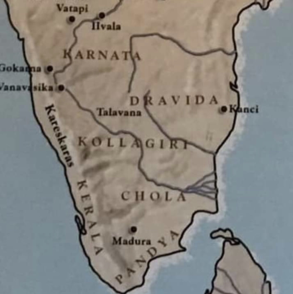
To the west of Andhra was the kingdom of ‘Kuntala’ which is the modern day “Uttara Kannada” and South Maharastra region. To the North-West of Kuntala was Goa which was then known as Aparanta. To the South of Kuntala is the kingdom of Karnata which is the Bangalore region.

To the South of Karnata, are the three countries of Tamilakam. The country of Dravidas & their capital of Kanchi. The country of Pandyas & their capital Madura(madurai) in the extreme South. The country of Cholas on the banks of Kaveri.The country of Keralas in the Malabar coast.

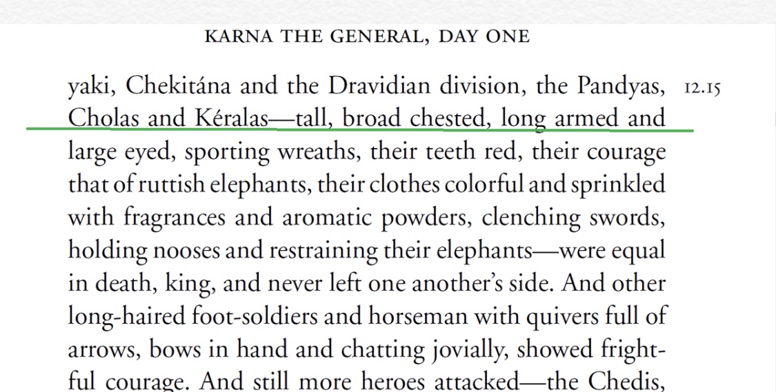
In the Karna Parva(12.15) of Mahabharata, all three kingdoms: Pandyas, Keralas and Cholas are clubbed as “Dravidas”.
Described as tall and broad chested warriors with courage like that of ruttish elephant.
Dravida= entire region comprising today’s Tamilnadu and Kerala.

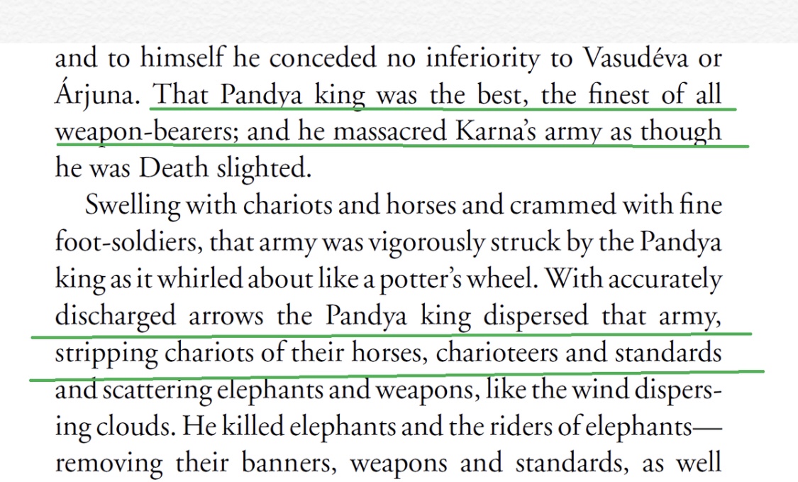
In the Mahabharata war, the Pandya king fought on the side of Pandavas. He slaughtered the armies of Duryodhana.
He slaughtered the Bahlikas, Khasas, Kuntalas. His bravery was praised in Mahabharata. In the end, he was k!lled by the Drona’s valiant son Aśvatthāmā.

The city of Gokarna in the South Konkana region was already famous in Mahabharata (3.275 vulgate) as “the favorite resort of Lord Shiva”.
Agastya’s hermitage existed to the south of it. And it was here that Vatapi was “digested” by Agastya according to Puranic lore.

In the Central India roughly corresponding to Malwa region and western Madhya pradesh was the country of “Avanti”.
Ujjayani (Ujjain) was the capital of Northern Avanti and Mahishmati on the banks of ‘Narmada’ was the capital of Southern Avanti.

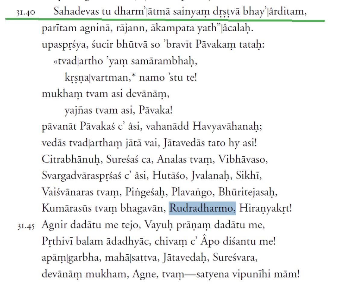
According to Mahabharata, Mahishmati had a formidable fortress protected by Lord Agni himself who had never been conquered in the past. Sahadeva appeased the God by offering a Yajna before he went on to conquer the city.

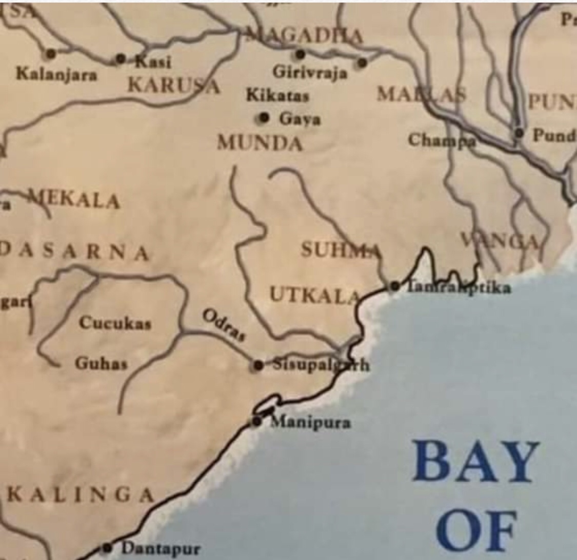
To the north of Kalinga was the country of “Odras” which is today’s “Western Odisha”. This region was famous for the Mahendragiri mountain which according to Mahabharata and Ramayana was a resting place of Lord Parashurama. Its capital was Manipura near today’s Kendrapara.

It must be mentioned that the Manipura of Mahabharata is near the Mahendragiri mountain (on the Andhra-Odisha border in Gajapati district/Srikakulam district).
Today’s “Manipur” in the North East got its name after 16th century. (It was earlier known as Kangleipak)

Today’s Manipur in NE India was actually renamed by Vaishnava migrants from this place.
To the north of Brahman river was the country of “Utkalas”. To its North in the Padma basin was the country of “Vanga”, which is today’s Padma Delta of southern Bangladesh.
Author:- True Indology @TIinExile
